"The exhibition, which is part of the string of events dedicated to the WWI and Greater Union Centennial, is aimed at providing a cartographic illustration of the various historic moments that preceded the creation of Greater Romania, at presenting the ethnographic maps used during the negotiations of the 1919 - 1920 Paris Peace Conference, as well as the reflection of the new territorial, geopolitical and social-economic dimensions in interwar cartographic materials," a release from the Ministry of National Defense informs on Monday.
The exhibition covers a historical period that starts with the Unification of the Romanian Principalities in 1859, a reality translated into the Chart of the United Principalities and Bessarabia, which was created in 1861.
The 85 maps, plans and cartograms included in the exhibition cover the historical trajectory of this geographical area until WWII, with the map produced in 1941 by the Military Geographical Institute - The Number of Inland and Out-of-country Romanians Before and After the Country's Division - closing the documentary chronology.
"The diplomatic activity at the end of the Great War focused on the creation of the new states, and themed cartography proved to be one of the main tools used to shape the political decisions of the time. Back then, the European states set up expert committees of reputed geographers, tasked with collecting data and producing cartographic documents," the release said.
The exhibition, organized at the initiative of the National Office for the Heroes' Cult, offers illustrated proof that all the segments of the Romanian society shared the sacrifice of the Romanian troops during WWI, that caused over 330,000 military casualties; cartography had a major contribution to the successful settlement of the Romanians' legitimate, national and political claims at the 1919 - 1920 Paris Peace Conference.
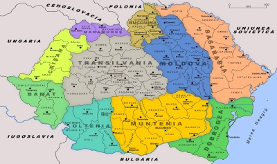
Exhibition 'Greater Romania Reflected in Cartographic Representations' to open at Romanian Academy Library
Sursă foto: stiripesurse.ro
Distribuie articolul
The exhibition titled "Greater Romania Reflected in Cartographic Representations" will be shown October 23 to November 2 at the 'Theodor Pallady' Hall of the Academy Library, by the National Office for the Heroes' Cult.
Distribuie articolul

Explorează subiectul
București -3°C
-3°C
Articole Similare

7
President Nicusor Dan: Signing of Romania-Ukraine Strategic Partnership declaration an important moment in bilateral relations
7

8
JusMin Marinescu on protest related to proposals for heads of major prosecutor's offices: We are a free country
8
9
President Volodymyr Zelenskyy: Iran, an ally of Russia, has supplied hundreds of thousands of shells and drones
9

9
Fiscal Council: 2026 budget framework compatible with a 6.25% of GDP cash deficit
9

17
19th edition of One World Romania documentary and human rights film festival to start on April 24
17
13
Romania is safe and will be even safer once U.S. capabilities are in country (President Dan)
13

7
Zelensky: US and over ten other countries ask Ukraine for support in shooting down drones
7
8
Romanian hauliers to get RON 0.85 per l of diesel under extended state aid scheme (draft)
8
6
Gov't memorandum allows Romania to participate in Important Projects of Common European Interest on Advanced Semiconductor Technologies)
6
9
50.4% of Romanians opt for striking a balance between EU, U.S. (poll)
9

13
ORNISS to guarantee protection of classified information generated under the Maritime Multi-Purpose Corvette Programme
13

8
British band Humour to perform in Bucharest for the first time on March 17
8
5
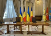
Romania, Ukraine sign strategic partnership, other defence, energy collaboration documents
5


Comentează