The project for the implementation of Romania's water cadastre has been reclassified to the grant category under the National Recovery and Resilience Plan (PNRR), following a negotiation with the European Commission, although it had initially been classified as a loan, and is nearing completion, the Apele Romane National Administration (ANAR) announced on Monday.
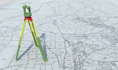
"Thus, the object of the 'Creation of a water cadastre,' a project funded under Investment 6 PNRR, is the delimitation of the minor riverbeds of the watercourses, by using techniques of interpretation and semi-automatic processing of the digital land model, the digital model of the surface, the orthophoto plans and the satellite information available for about 70% of the length of the cadastral watercourses, the determination by semi-automatic methods of the hydro-morphologically active areas (erosion/sedimentation). The deadline for completing the implementation of this investment is December 30, 2025, and currently the object of the contract is 75% completed. From the activities that are the basis of the service contract, the LiDAR and photogrammetric flights are completed, with the rest of the activities being in progress and fit into the implementation schedule," according to ANAR.
The objective of the water cadastre is the registration with the Integrated Cadastre and Land Book System of all the buildings belonging to the Public Domain of the Romanian State, under the administration of ANAR.
At present, the promotion of investments in the field of water management is difficult, as it is necessary to take steps to tabulate the sectors that require the implementation of the measures proposed under the flood risk management plans and in the river basin management plans carried out in Romania in the process of implementing the Floods Directive (2007/60/EC) and the Water Framework Directive (2000/60/EC).
"At the same time, the need for inter-institutional cooperation and the development of other types of infrastructures that are connected (cross) with water (roads, railways, electricity and gas transmission networks, etc.) require clarity in the property owned by the Romanian state and private owners in order to ensure the appropriate development conditions. Also, the creation of the water cadastre will also allow the limitation of possible legal disputes determined by the overlapping of properties that occurred in the tabulation process at national level. At the level of basin administrations, the water cadastre provides the necessary database for decision-making on the concession, use and protection of water, providing the necessary support for identifying areas vulnerable to floods or drought and adopting appropriate protection measures," according to ANAR.


So far, under the Water Cadastre project, the following have been carried out: aerial photography for an area of 195,65 square km, representing 82.20% of the total area of Romania; aerial laser scanning for an area of 39,787 square km, representing 79.57% of the contracted area; delimited and digitised minor riverbeds for 49,700 linear km, representing 90% of the contracted area; the software platform for determining the change in the riverbed and the management of the data under the project is fully functional, with access accounts being created and transmitted to the users within ANAR.
"Through the data it provides, the water cadastre supports the planning and implementation of infrastructure works (water supply, irrigation, flood protection, etc.) and the development of strategic decisions for these areas, ensuring compliance with national and European legislation, including the Water Framework Directive (EC/60/2000). Also, the cadastre of watercourses will allow the identification of areas with significant changes in land use, the extension of urbanization becoming a support tool in correlating spatial development actions, with the consideration of natural hazards (floods, landslides, erosion phenomena, etc.), which will allow a significant improvement of the approach of integrated water resources management at the level of the national hydrographic basin and the implementation with the provisions of the Water Framework Directive (2000/60/EC), the Floods Directive (2007/60/EC) and the Inspire Directive (2007/2/EC)", according to ANAR.
As far as attracting European funds is concerned, the Water Cadastre will provide the technical data for carrying out feasibility studies necessary for the development of funding projects, providing the basic information that justifies the need for investment.


Comentează