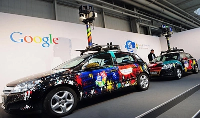
Google Street View cars are back to Romania this summer to update Google Maps local photos, the company said in a release this Monday.
The focus this year will be on capturing photos of the highways and roads connecting localities, and the cars will be underway for two months beginning June 25.
A Street View project exploring the Danube Delta is also unfolding in cooperation with the World Wide Fund (WWF) Romania. Street View images from various Transylvanian tourist destinations will also be published on Google Maps in the coming period.
The Street View service has been available in Romania since 2010, when the first images from the country's major cities were published on Google Maps. Countrywide Street View coverage was achieved in 2012, when images were captured for 40,000 km of roads, 39 cities and hundreds of tourist destinations.
Street View has continuously expanded in Romania with updates from the major cities and the addition of various tourist attractions, such as the Turda salt mine, the Bran Castle, the Alba Iulia citadel, the Brukenthal National Museum in Sibiu and the Danube River.
Google Street View cars back to Romania for local image updates
Sursă foto: stiripesurse.ro
Distribuie articolul
Distribuie articolul

Explorează subiectul
București -1°C
-1°C
Articole Similare
7
Gov't approves draft law on state social insurance budget for 2026
7
8
PM Bolojan: If fuel prices continue to rise, we will consider limiting them
8
7
President Nicusor Dan: Signing of Romania-Ukraine Strategic Partnership declaration an important moment in bilateral relations
7
8
JusMin Marinescu on protest related to proposals for heads of major prosecutor's offices: We are a free country
8

9
President Volodymyr Zelenskyy: Iran, an ally of Russia, has supplied hundreds of thousands of shells and drones
9

9
Fiscal Council: 2026 budget framework compatible with a 6.25% of GDP cash deficit
9

17
19th edition of One World Romania documentary and human rights film festival to start on April 24
17
13
Romania is safe and will be even safer once U.S. capabilities are in country (President Dan)
13
7
Zelensky: US and over ten other countries ask Ukraine for support in shooting down drones
7
8
Romanian hauliers to get RON 0.85 per l of diesel under extended state aid scheme (draft)
8
7
Gov't memorandum allows Romania to participate in Important Projects of Common European Interest on Advanced Semiconductor Technologies)
7

9
50.4% of Romanians opt for striking a balance between EU, U.S. (poll)
9
13
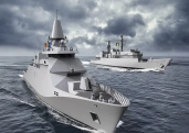
ORNISS to guarantee protection of classified information generated under the Maritime Multi-Purpose Corvette Programme
13


Comentează